The National Weather Service in Charleston is predicting one more day of high heat on Sunday, August 1, 2021. This caps three days of intense heat for our area.
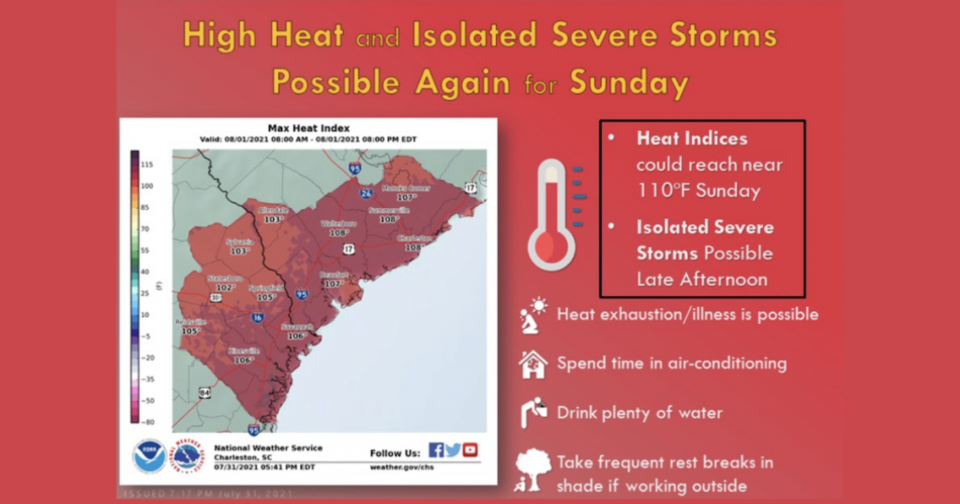
Heat indices are forecast to possibly reach near 110 degrees. There is also a possibility of later afternoon severe storms. The NWS has issued a hazardous weather outlook for Southeast Georgia, including Bulloch for today and into next week.
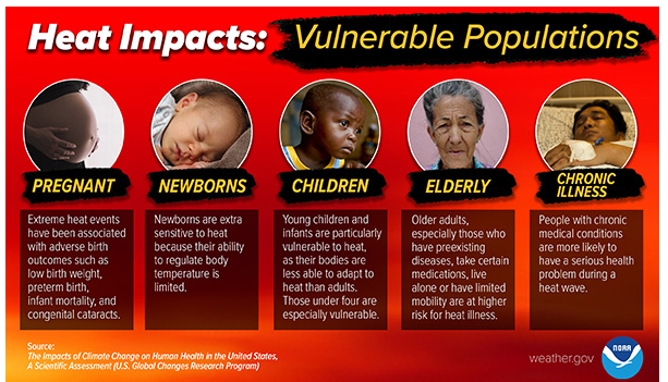
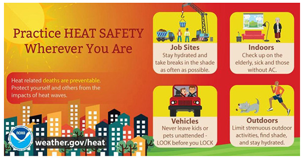
Review these NWS Heat Safety tips:
However, these storms will bring a much needed break for the intense heat wave.
This Hazardous Weather Outlook is for southeast Georgia and southeast South Carolina.
Sunday, August 1 - DAY ONE...Today and tonight.
Severe Thunderstorms: Scattered showers and thunderstorms are expected to develop over the area this afternoon and evening. Isolated severe thunderstorms with damaging winds will be possible. In addition, intense, frequent cloud-to-ground lightning could also occur. Take shelter if thunderstorms approach.
Monday, August 2 - Saturday, August 14 - DAYS TWO THROUGH SEVEN...Monday through Saturday.
Heavy Rainfall/Flooding: Unsettled weather will develop across the area this week as a cold front stalls near the region. Periods of locally heavy rainfall are likely with flooding possible, especially in low-lying and poor drainage areas.
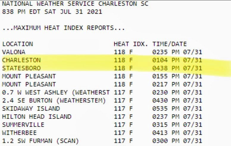
On Saturday, heat indices reached 118 at the Statesboro Airport.
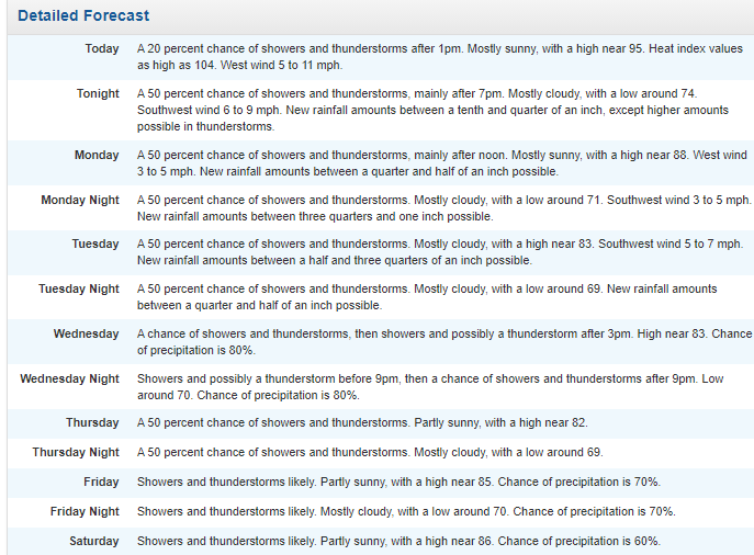
NWS Seven Day Detailed Forecast for Bulloch