
With highs reaching nearly 80 on Tuesday, October 31, 2023 the cold weather on the way will be a bit of a shock to many. The National Weather Service in Charleston has issued a freeze watch beginning at 2:00 AM on Thursday, November 2, 2023 through 10:00 AM on Thursday, November 2, 2023.
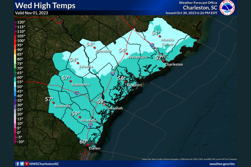
The forecast highs for Wednesday, November 1, 2023 is 57.
CLICK HERE for current weather conditions.
Detailed Forecast for Statesboro
Tuesday afternoon
Mostly sunny, with a high near 77. North wind 7 to 9 mph.
Tuesday night
Mostly cloudy, with a low around 43. North wind around 10 mph.
Wednesday
Sunny, with a high near 57. North wind 11 to 15 mph, with gusts as high as 23 mph.
Wednesday Night
Clear, with a low around 33. North wind around 6 mph.
Thursday
Sunny, with a high near 61. Northeast wind 7 to 10 mph.
Thursday Night
Clear, with a low around 38.
Friday
Sunny, with a high near 69.
Friday Night
Mostly clear, with a low around 47.
Saturday
Mostly sunny, with a high near 75.
Saturday Night
Partly cloudy, with a low around 51.
Sunday
Mostly sunny, with a high near 76.
Sunday Night
Mostly clear, with a low around 50.
Monday
Mostly sunny, with a high near 76.
FREEZE WATCH REMAINS IN EFFECT FROM LATE WEDNESDAY NIGHT THROUGH THURSDAY MORNING
Jenkins-Screven-Candler-Bulloch-Evans-Allendale-Hampton-Inland Colleton-Dorchester-Including the cities of Millen, Sylvania, Metter, Statesboro,
Claxton, Allendale, Hampton, Yemassee, Walterboro, Saint George, and Summerville
959 AM EDT Tue Oct 31 2023
* WHAT...Sub-freezing temperatures in the 30 to 32 degree range possible.
* WHERE...Portions of southeast Georgia and southeast South Carolina.
* WHEN...From late Wednesday night through Thursday morning.
* IMPACTS...Frost and freeze conditions could kill crops, other sensitive vegetation and possibly damage unprotected outdoor plumbing.
PRECAUTIONARY/PREPAREDNESS ACTIONS...
Take steps now to protect tender plants from the cold. To prevent freezing and possible bursting of outdoor water pipes they should be wrapped, drained, or allowed to drip slowly. Those that have in-ground sprinkler systems should drain them and cover above-ground pipes to protect them from freezing.


